Survey Planning
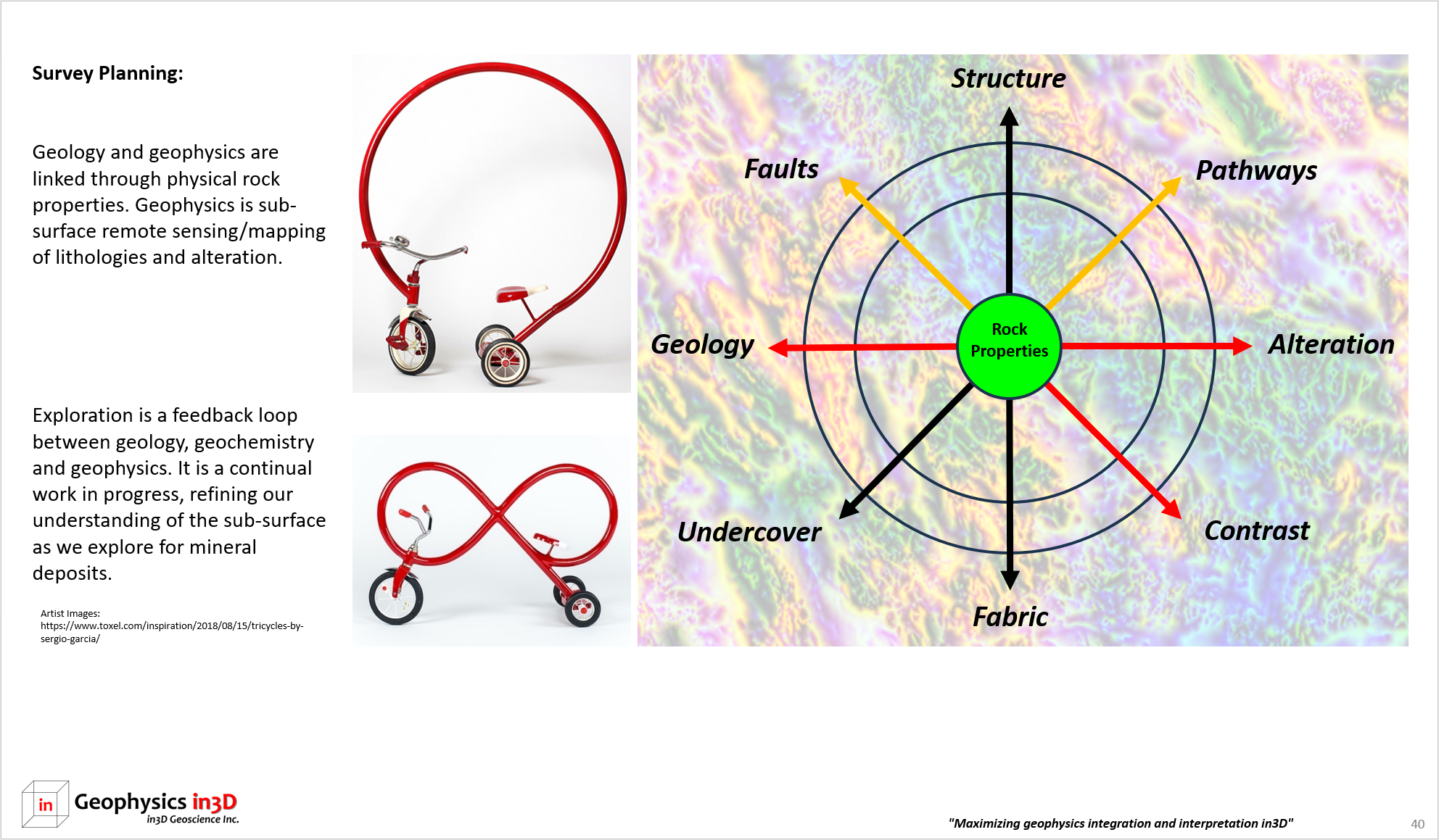
Survey Planning:
Survey planning begins with survey type and design that are best suited for your exploration needs. Contract negotiations are often overlooked: data acquisition parameters with respect to measurement tolerances (practical limitations of sensitivity and resolution) are an important consideration. Data modelling can be conducted in order to refine survey parameters and confirm that a target of interest or conceptual model will be appropriately delineated. Target detection and delineation are not necessarily the same. Clearly defining survey objectives is crucial.
Choosing the correct survey type is also a key first step.
- Is your target known or conceptual?
- Are there any target variations? Could aspects of the conceptual model be missing or distorted by faulting or folding?
- What are the defining characteristics of the model in terms of physical rock properties? Do all lithologies have contrasts?
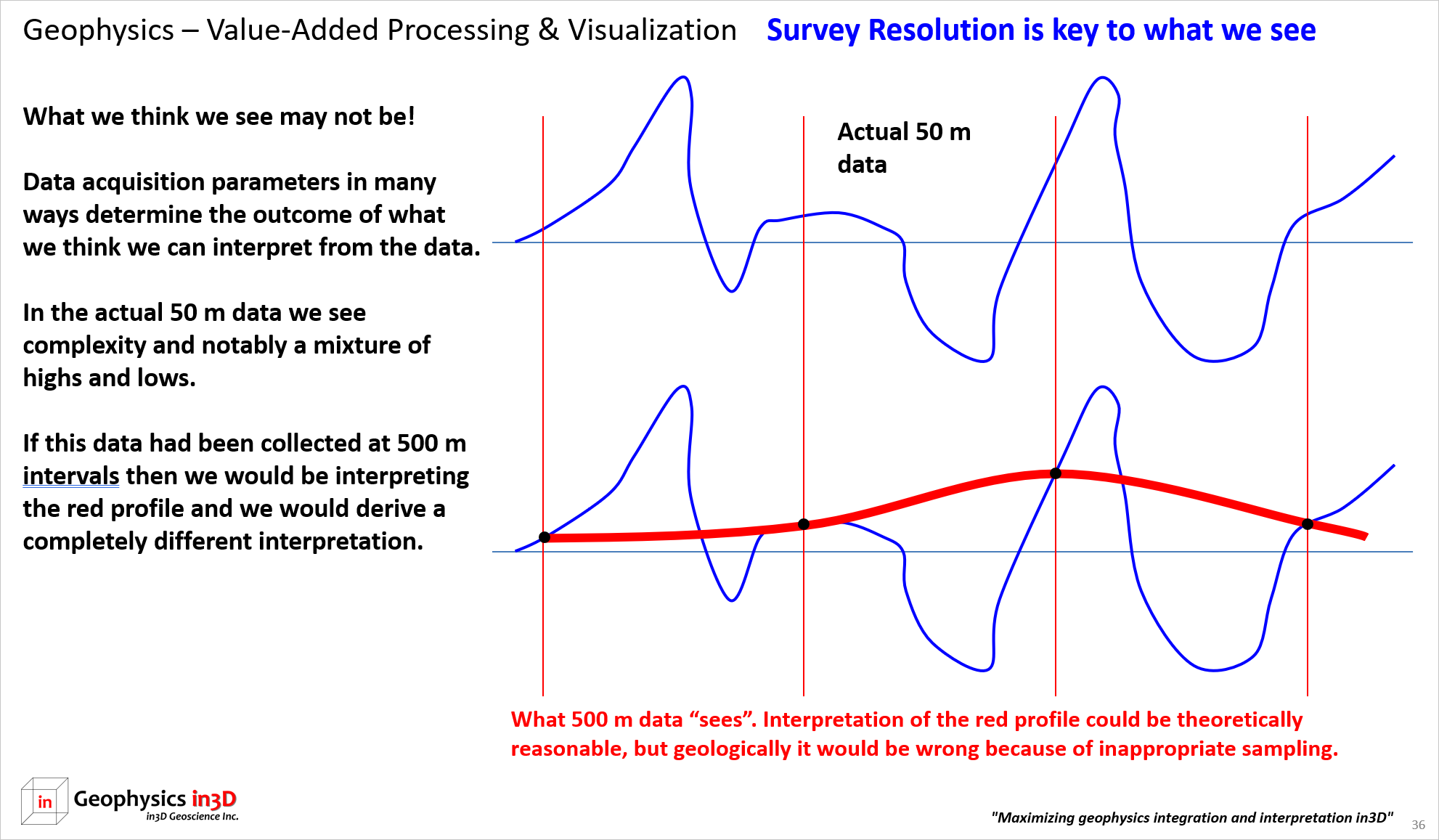
- How is the geology represented as physical rock properties? Think of geophysical rock property geology as much simpler than typical geology. For example, two lithologies clearly mapped as different may not be able to be mapped geophysically because their rock property characteristics are too similar, or the scale of the geophysical survey is insufficient. Scale refers to the measurement density or spacing and the distance from the geology. If performing petrophysical measurements on drill core we can resolve significant detail. If conducting an airborne magnetic survey at 100 m above ground, we can only resolve a large and stronger rock property contrasts.
- How do rock properties such as magnetic susceptibility, density, resistivity, porosity and gamma radiation factor into your target model?
- Is your target amenable to direct detection through mapping physical rock properties or would geologic mapping be a contributing factor to further exploration?
- Geophysical measurements are directly related to geology, mineralization and alteration.
- Successful geophysical surveys require that physical rock property contrasts be large enough to be measurable from either ground or airborne surveys.
- Target size, depth, geometry and amplitude of rock property contrast are key factors in detectability.
- What is the role of alteration and its effect on rock properties? Is there evidence of magnetite destruction?
- Are multiple survey types required in order to maximize geologic mapping and direct detection?
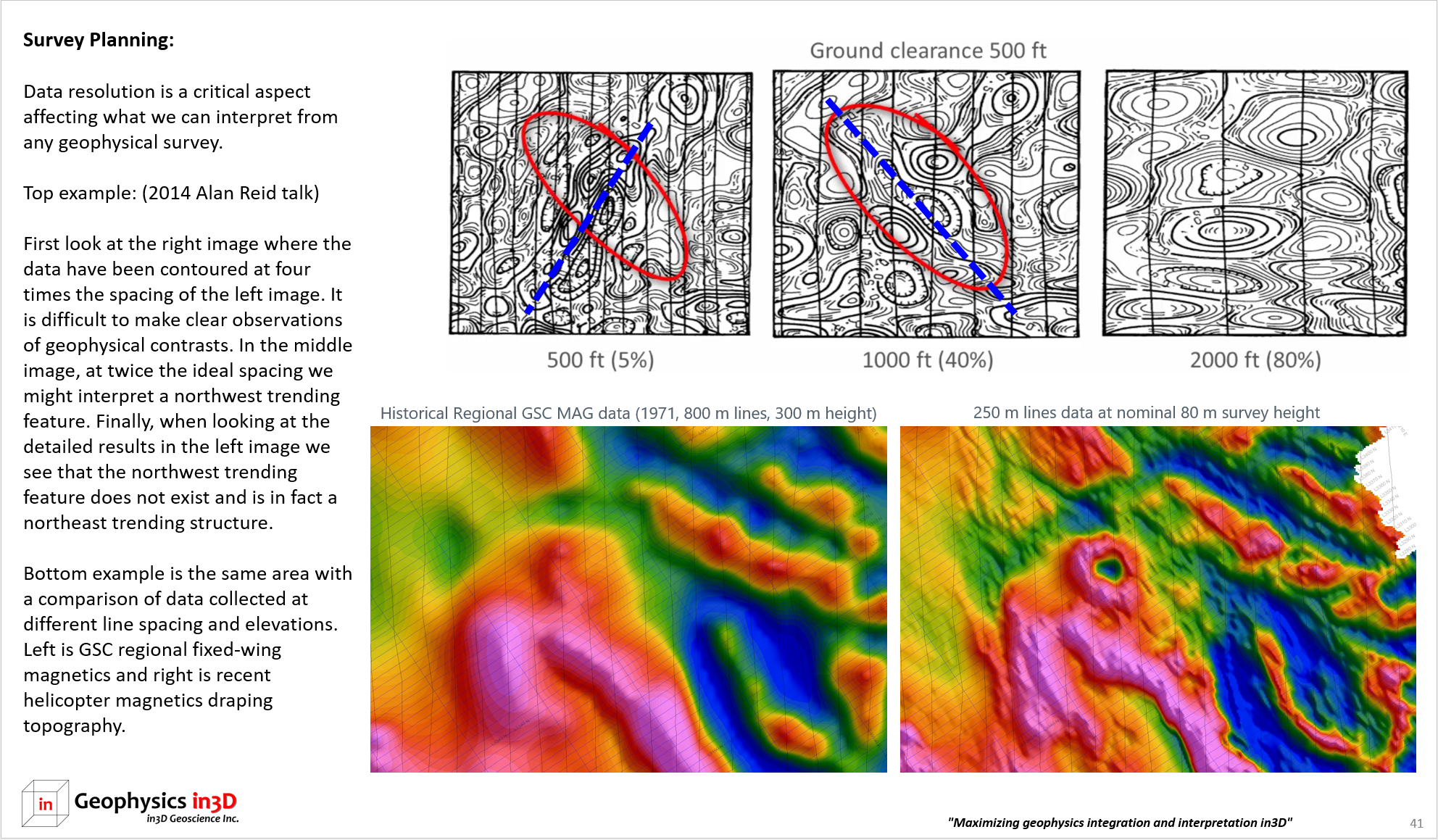
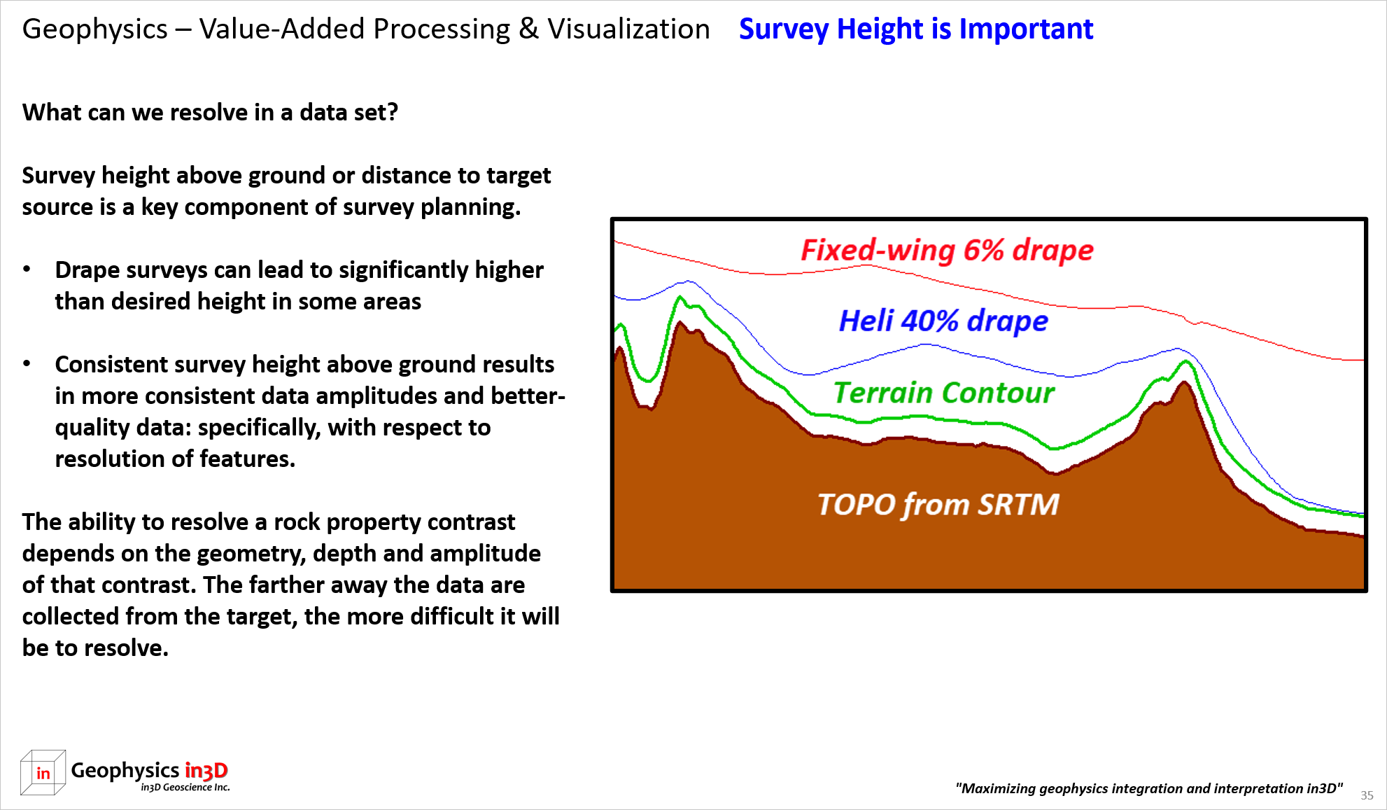
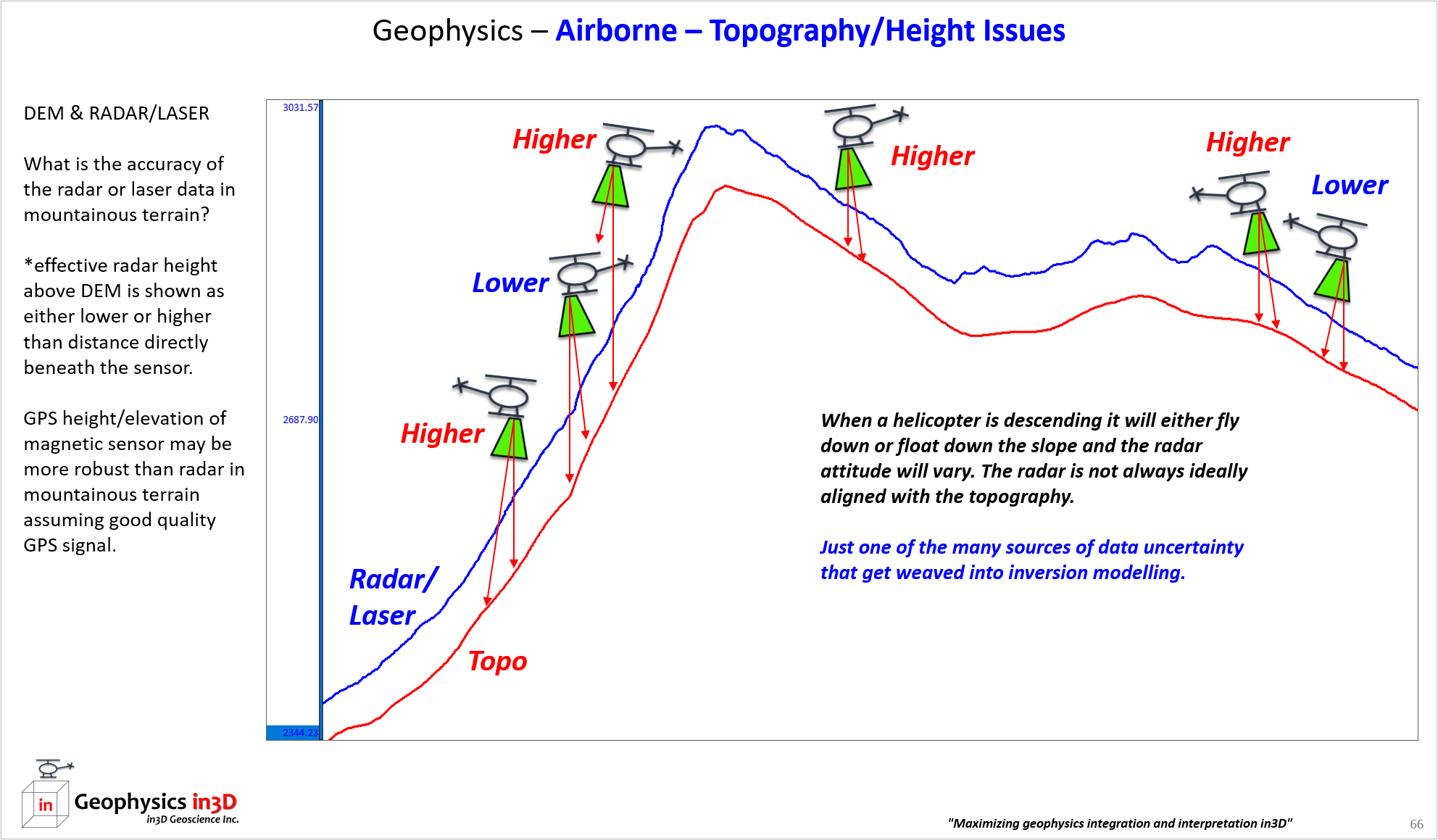
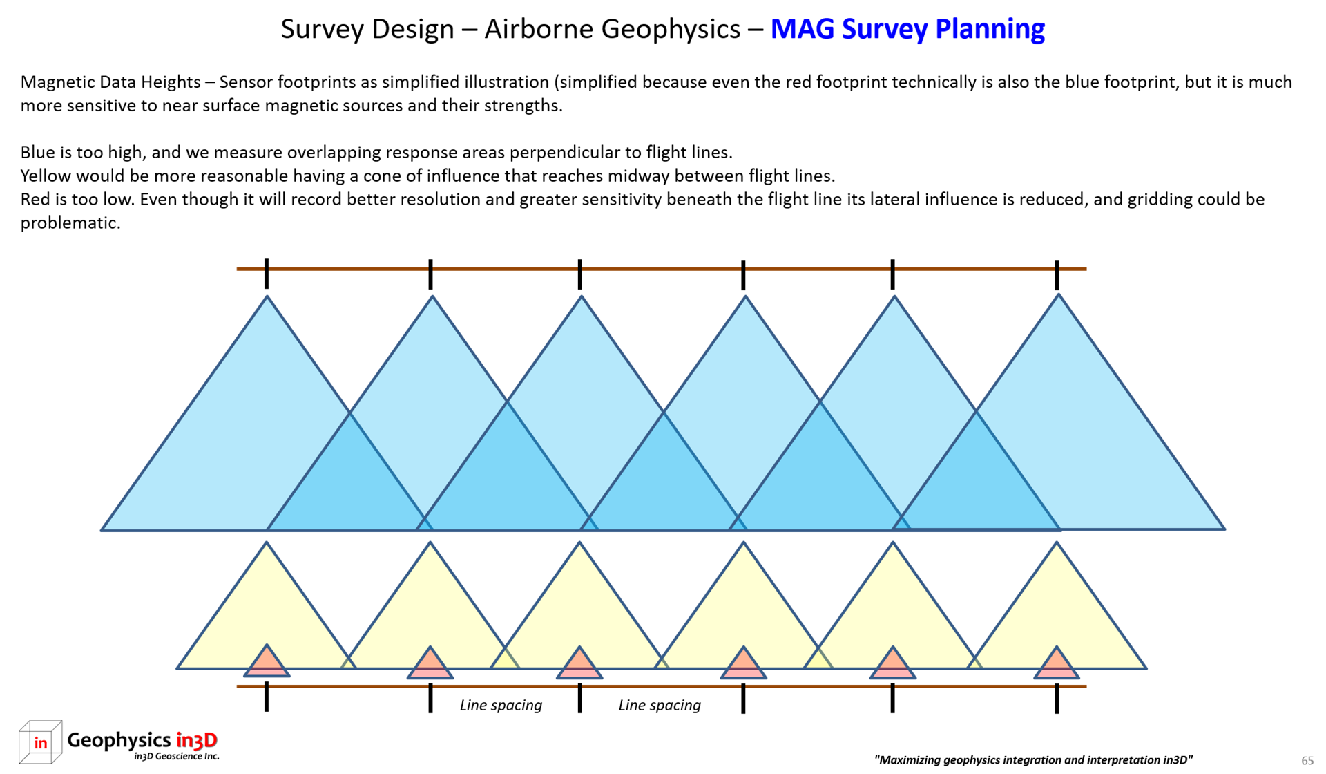
- Survey design takes into account known information as well. Airborne survey height is an important consideration – see image below.